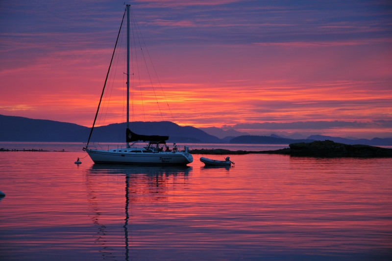
There’s something very special about Sucia Island Marine State Park’s incredible beauty, many bays, coves, beaches, and trails. Its shoreline is the product of Mother Nature’s artistry with smooth sandstone curves, rounded arches, and honeycomb hollows, plus six bays possessing their own unique personality. You can spend a week at a time here and every night in a different moorage. What brings boaters back time after time is: the beauty of the park comprised of 11 islands, 564-acres, 77,700-feet of shoreline; 48 mooring buoys, 2 docks (640’), 2 linear moorage systems (800’); 60 onshore campsites; and10 miles of hiking trails.
Located just south of the U.S/Canadian border in the northern portion of the San Juan Archipelago, the park is made-up of a series of long fingers running in a southeast direction. Visitors need to use caution when navigating the waters around the Island. Francisco de Eliza, leader of the 1790 Eliza Expedition labeled the land mass “Isla Sucia” on his chart, the Spanish word “foul” or “dirty” in reference to the rocks and reefs surrounding the island.
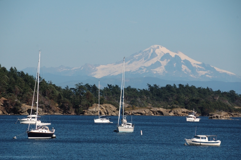
Fossil Bay is one of the park’s most popular moorages. During the summer, boats raft on the 16 mooring buoys. The two docks are cluttered with deck chairs and barbeques. The bay takes its name from the fossils found in the surrounding bluffs. Twisting flesh-colored Madrona trees are everywhere. At the head of the first dock is a plaque and sign memorializing Ev Henry and the 40 yacht clubs that purchased and donated over 300 acres of the island into the state in 1960.
Snoring Bay is east of Fossil Bay around Wiggins Head, has two mooring buoys, with anchoring room for a couple additional boats. Legend has it that the bay’s name was coined after a park ranger caught napping by visiting officials.
Echo Bay is the largest and deepest bay on Sucia, with enough room for anchoring on even a crowded holiday weekend. The bay offers fourteen mooring buoys and 2 linear moorage systems. The bay’s flat, sticky clay bottom offers secure anchorages for dozens of boats. At the head of the bay there is a steep gravel beach, with driftwood at the high-tide line, making for a good dinghy landing. A narrow isthmus separates Echo and Shallow Bays, and it’s a brief walk between the two. For many visitors this is a starting point for exploring the island. The hiking trail system crosses the isthmus and fans out across the island.
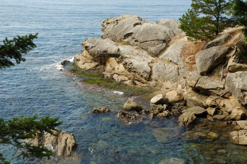
Ewing Cove lies northeast of Echo Bay, formed where Ewing Island, Cluster Islands and Sucia create a small bay with four mooring buoys amidst the rocks. Although there’s limited space, it’s a choice spot. Anchoring is not suggested due to the swift currents racing into the cove through a slot between Ewing and Sucia Island. When entering the cove from Echo Bay, there is an uncharted rock that lies just below the surface east of the “Fish Haven” shown on the chart. It is dark, hard to see, and feeds on propellers. There is a wonderful gravel beach, perfect for sunbathing and imagining what the island was like years ago. The Cluster Islands are an intriguing string of islets forming the southern boundary of this cove. Visitors enjoy roaming the beach exploring the tide pools.
Shallow Bay has two navigational aids marking the entrance into the bay and a break in the reef that protects small Shallow Bay. As its name implies, it’s only 8-feet deep in its center at zero tide. The sun can warm the water enough to swim or wade for the brave individual, although at times scummy seaweed can make swimming unappealing. This west facing bay offers eight mooring buoys, limited anchoring, sandy beaches, and some of the most spectacular sunsets anywhere in the San Juan Islands. The bay’s northeast shoreline has been chiseled by the wind and water creating a series of overhangs, ridges, caves, and hollows. The area named China Caves sheltered illegal laborers being smuggled into the country in the late 1800s.
Fox Cove is located on the southwest side of the island with its steep 100-foot-high sculptured sandstone cliffs. There is a shallow, sandy, and muddy beach at the head of the cove. Four buoys are located offshore. Here is where another one of the island’s unique sandstone shapes can be found. Located on the north shore is an 8-foot-high mushroom rock.
With all it as to offer Sucia Island is an amazing place to visit.
