Located within the boundaries of Desolation Sound Provincial Park and only a 7.3-mile passage for Refuge Cove on West Redondo Island, the first glimpse of the Tenedos Bay leaves a lasting impression, with its steep encompassing rock cliffs, emerald-green water, and a view of 483-meter Mt. Spooner to the southeast. All the ingredients are here for an excellent anchoring experience, sheltered coves, stunning scenery, and water warm enough for swimming.
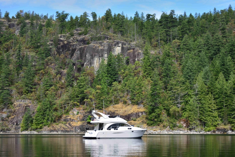
At over fifty fathoms, the center of Tenedos Bay is too deep for anchoring. When Archibald Menzies, an officer in Captain Vancouver’s survey team, visited the bay in 1792 he named it Deep Bay.
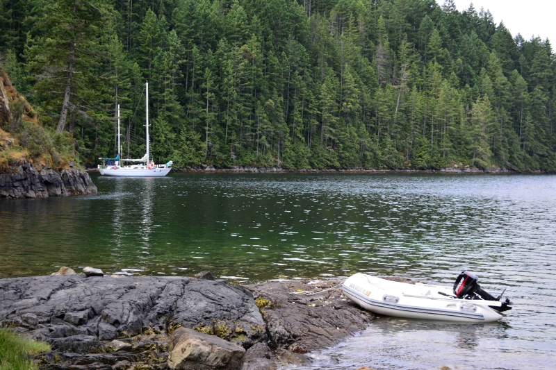
There is ample anchoring with fourteen stern-tie installations with pin-and -chain stern tie anchors around the bay, and anchorage spots in some of the smaller coves. On the west side of the bay additional good anchorage can be found in a secluded spot known as Three Fathom Cove. Here a drying tombolo forms the head of this narrow anchorage, separating the cove and the inner bay at low water, where it connects the mainland shore with the unnamed forested Island. The swing room is limited so a stern tie is a good idea.
A favorite anchorage with pin-and -chain stern tie anchors is located on the eastern shoreline. Also located here is a stream that flows from Unwin Lake and a trail that leads to the lake and beyond. Kayakers beach their craft here and pitch tents in a grassy primitive campsite next to the stream. There is a fire pit, picnic tables, a pit toilet, and a park information board.
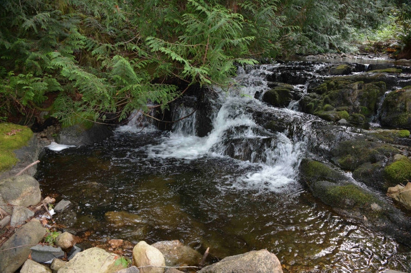
The short half-kilometer hike to the lake along the trail is lovely as you wind your way beside the stream and through the forest. Several pools in the stream are popular for soaking on warm summer days. Along the trail there are stumps with springboard notches, providing a glimpse of the area’s history. The trail splits and the southern trail, to the right, leads to the head of the stream and lake. Upon your arrival you’ll discover the head of the stream is jammed with sun-bleached logs holding back beautiful Unwin Lake. The trail continues along the south side of the lake.
The northern trail crosses the stream just before the lake and leads to the large flat swimming rocks where many elect to take a refreshing dip and sunbath. It is also common for some to make the portage with their kayaks to explore this clean pristine piece of paradise. The trail continues to a couple of smaller lakes and beyond, all the way to Melanie Cove in Prideaux Haven on the northern side of this BC Mainland peninsula. It takes about one and a half hours to hike the entire trail one way.
Back on your boat, grab your camera and motor the dinghy out to the mouth of the bay for some wildlife photo opportunities. With eagles feeding on the shoreline and there are drying rocks where seals bask in the sun. As you approach, the seals are very accommodating providing some great photo opportunities. The bay offers several nooks and coves that are great for exploring by dinghy or kayak, while passing scenic granite cliffs and beautiful Madrones; the entire bay is quite lovely.
After exploring the bay’s shoreline and capturing those wildlife photos, return to the mother ship to enjoy the late afternoon sun and take in the sights with your favorite beverage in hand before enjoying a comfortable night’s sleep and weighing anchor in the morning before heading-off on your next Desolation Sound adventure.
