Thurston Bay Marine Park’s 531-hectares is located on BC’s South Central Coast in the Discovery Islands area on the westside of Sonora Island. Accessible only by boat via Nodales Channel, boaters can reference marine chart #3539 and #3543 for more information on the area. The park is in the traditional territories of the Homalco, K’omoks, We Wai Kai and We Wai Kum Nations. From 1914 to 1941 Thurston Bay was the regional centre of maritime operations for the BC Forest Service and had a maintenance facility for the fleet of forest patrol vessels. The park was established in 1970. It’s made up of two separate portions, one bordering and taking up part of Thurston Bay and the other bordering Cameleon Harbour and Handfield Bay.
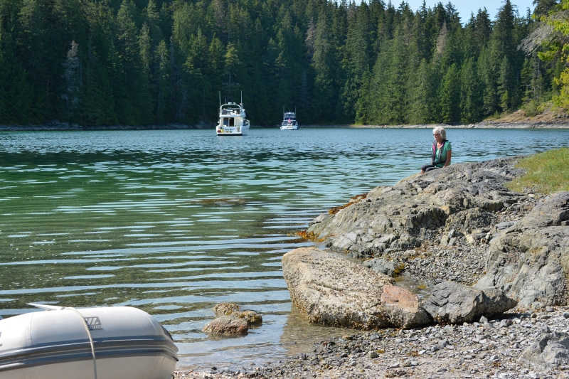
A safe approach into Thurston Bay can be made either to the north or south of Block Island. The northwest corner of the bay offers anchoring northwest of the two Islets in 30-feet over a good holding sand and mud bottom, although exposed to westerlies out of Johnstone Strait.
Pets and domestic animals must always be on a leash and are not allowed in beach areas. You are responsible for their behaviour and must dispose of their excrement.
The Islets and shoreline are fun and interesting to explore, and a narrow grassy isthmus connects the islets to Sonora Island. Behind the Islets a stream feeds the bay. A 1.5-mile trail, now overgrown, once ran along the stream to Florence Lake. South of the park is an old homestead with a creek emptying into the bay.
Rumor is the crabbing can be good and during the season fishing for salmon can be outstanding. Rockfish Conservation Areas occur within the park. Fishing activities are limited in Rockfish Conservation Areas. Before you go fishing please refer to the Rockfish Conservation Area descriptions available from Fisheries and Oceans Canada, Rockfish Conservation Areas.
The southern portion of the park is accessed through either Young Passage from the west or Burgess Passage to the north into Cameleon Harbour then north into Handfield Bay. Visiting mariners need to be aware of the charted drying Douglas Rock off Bruce Point and the drying foreshore of Greetham Point.
Cameleon Harbour was named in 1863 by Captain Daniel Pender – captain of the HMS Plumper, and HMS Hecate from 1857 to 1870 – after the H.M.S. Cameleon which participated in the original in-depth survey of the area.
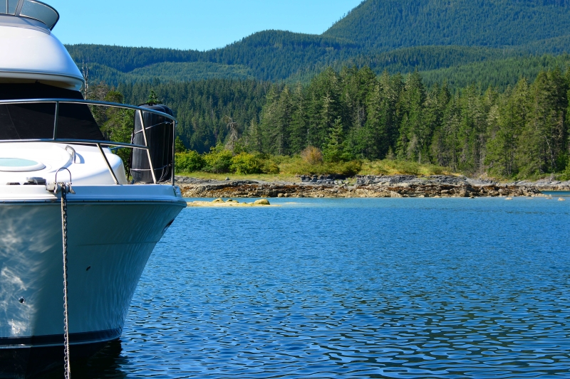
Guidebooks state there is excellent holding in Cameleon Harbour over sticky mud, but a west wind can funnel through making the anchorage uncomfortable at times.
The preferred all-weather anchorage is in Handfield Bay. This quiet pocket bay is protected by Sonora Island on three sides and Tully Island and an unnamed islets to the south.
To enter Handfield Bay, move slowly between Tully Island to port and the islets to starboard. The bay provides anchoring in 12-feet of water at a low datum over a mixed sand and shell mud bottom. This is a beautiful anchorage, and just the gunkhole situation every boater cherishes. The pocket anchorage – with its islets, reefs, sandy beaches, pale green water, and mixture of deciduous and evergreen trees – can easily be home for a couple of days. Your time can be spent exploring the ample shoreline, or relaxing onboard and soaking up some of the warm summer sun. If you’re lucky you might even, see a brown bear or two rooming the shoreline.
If you enjoy foraging for your meals on one of your shore excursions pick some Sea Asparagus, aka Sea Beans, and try them with dinner. This gift from the sea has good nutrient content and additional health benefits.
