If you ever wondered why British Columbia and Washington State Ferries or other commercial vessel didn’t respond to your call on channel 16, there’s a reason; Vessel Traffic Services, known more simply as VTS. Imagine yourself as the Master of a container vessel or tanker listening to the uninitiated pleasure boater make a dire warning that someone has left their fenders down or the next guy trying make lunch plans, all while on channel 16.
VTS works much like the Air Traffic Control system and has its own set of rules. The Navigation Rules state, “Such ships may discontinue their watch on VHF channel 16 while in the VTS area.” Think of VTS (shipping lanes) as a highway with a median.
Vessel Traffic lanes are marked on nautical charts and show the routes that commercial traffic follows. The benefit of a chart plotter in our part of the world really comes in handy for knowing where you are in relation to the traffic lanes. If you cross a traffic lane the rules state that you must do so at 90 degrees, and that you may not impede a vessel that is participating in a traffic scheme, and that includes a boat under sail.
Most traffic lanes are one and quarter miles wide, consisting of a half mile lane in each direction divided by a quarter mile separation zone (think highway median.) A few notable exceptions in our part of the world are Rosario Strait, where traffic is routed in only one direction at a time and the Straights of Juan de Fuca, where the lanes and separation zone are wider.
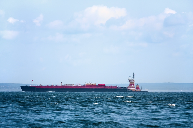
Vessels participating in the VTS lanes have the right of way over all other vessels, including sailboats.
The captains of commercial vessels know the Rules of The Road but aren’t always sure of what to expect from smaller boats. Vessels smaller than 20 meters are required to keep clear and out of the way of a vessel in a VTS lane.
As a pleasure boater you may use the channels listed below to communicate with VTS. Be sure to try to communicate directly with commercial vessels using VHF channel 13, (Bridge to Bridge) first. The default on channel 13 is low power. Typical calls are made for passing arrangements and during periods of fog. You may call a vessel or “the areas “Traffic” control directly. Also, before contacting VTS it’s helpful to begin listening to “Traffic” to understand the nuances.
If you are in the fog, “Traffic” will give you the positions and speed of any conflicting vessels as follows. Make your broadcast as concise as possible. For example, state:
Who you are?
Hail; Seattle Traffic – Beach House
Response; Beach House – Seattle Traffic (sometimes, simply Traffic)
Where you are and Your Intentions?
Hail; Seattle Traffic – Beach House, Eastbound Thatcher Pass for Anacortes, 8 kts
Response; Beach House, the Ferry Sealth has departed Ship Harbor for Orcas and I have a North bound tug and tow at Allen Island making 5 kts.
If you are making a long crossing “Traffic” may ask you to report in at various locations. “Traffic” will also announce your location to commercial vessels.
Additionally, you may call a vessel directly. If you don’t know the vessel’s name, you may identify it by location and type, for example the Northbound Tanker at Turn Point. Usually, the Master will thank you for calling.
When encountering large vessels, know that they typically travel at speeds of 20-25 knots. You should always pass astern of a large vessel. If you make a course change it needs to be large enough to be detected by eye and by radar.
VTS in the Canada and United States share responsibility for several areas. Here’s a brief breakdown:
VTS Location, VHF Channel, & Call Sign (South to North)
Puget Sound South, Bush Pt. in Admiralty Inlet and Possession Pt. in Possession Sound are the dividing lines for North and South Puget Sound 14, Seattle Traffic
Puget Sound North, including San Juans & Strait of Juan de Fuca that lies in US & Canadian waters 05A, Seattle Traffic
Haro Straight including US & Canadian waters, 11, Victoria Traffic Sector 2
Boundary Pass including US & Canadian waters, 11, Victoria Traffic
Vancouver Harbour including approaches, 12, Victoria Traffic
Southern Strait of Georgia, 11, Victoria Traffic
Northern Strait of Georgia from Ballenas Island to Cape Caution, 71, Victoria Traffic
Cape Caution to Alaska, 11, Prince Rupert Traffic
West Coast of Vancouver Island US & Canadian waters, 74, Prince Rupert Traffic
